


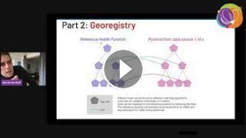
Iaso is a platform created to support geo-rich data collection efforts, mainly in public health in emerging countries. The key feature that it supports is that any survey is linked to an organizational unit that is part of a canonical hierarchy. Each one of these org. units can have a location and a territory. The mobile data collection tool can be used to enrich this hierarchy with additional GPS coordinates, names corrections, etc ... which can then be validated by officials of the organizations in question through the web dashboard (this is consequently similar in some aspects to OpenStreetMap, but with validation before integration in the reference dataset). This leads to continuous improvements of the geographic references available through the routine activities already planned (e.g. locating and registering health facilities while investigating malaria cases).
The tool has been used in multiple data collection efforts, notably in health services in D.R. Congo, Niger, Cameroon, Mali and Nigeria and is more and more used to compare multiple versions of official organisational hierarchies when a canonical one needs to be rebuilt. We are for example working on such efforts to rebuild a school map for DRC with the NGO Cordaid. To help for this type of project, we provide location selection interfaces, multiple levels of audits and an API open to data scientists for analysis and mass edits.
This presentation will demo the main features of the platform, and give some context about its creation.
Iaso has been created by the company Bluesquare (https://bluesquarehub.com/, based in Belgium), specialised in software and services for public health, and has become open source under the MIT License in November 2020.
It is still under heavy development, but is already the basis of at least a dozen projects. On the roadmap, we have features for a patient registry, monitoring tools for data collectors, and microplanning activities (producing routes for monitoring teams, or vaccination teams).
Iaso is made of a white labeled Android application using Java/Kotlin and reusing large parts of the ODK projects and a web platform programmed using Python/GeoDjango on top of PostGIS. Frontend is mainly React/Leaflet. One of the aims is the ease of integration with other platforms. We already have csv and geopackage imports and exports and target easy integration with OSM.
You can find the platform and its documentation here https://github.com/BLSQ/iaso
The mobile application is available here
https://play.google.com/store/apps/details?id=org.bluesquarehub.iaso.demo
Authors and Affiliations –
Martin De Wulf, Bluesquare.
Track –
Software
Topic –
FOSS4G for Sustainable Development Goals (SDG)
Level –
2 - Basic. General basic knowledge is required.
Language of the Presentation –
English
- Catégories
- Cils
Ajouter un commentaire
Up Next
Autoplay
-
01:18

Robes de soirée - MARCHESA Collection 2021
-
12:19
Pronovias 2021 : Défilé robe de mariée Collection 2021
-
01:18
Robes de soirée - Tony Ward Collection 2021
-
01:18
Robes de soirée - COUTURE CLUB Collection 2021
-
00:49
Nouvelle collection Oh blush été 2021 VACATION
-
07:59

15 COIFFURES FACILES POUR LES PETITES FILLES
-
04:48

Comment faire une tresse sur le côté ? Tuto coiffure simple et belle avec tresse
-
05:52

10 IDÉES COIFFURES POUR CHEVEUX CRÉPUS | Shelby Bj
-
12:24

➳ 7 idées Coiffures sur Cheveux COURTS (longueur épaules) | L.A Hairstyle Inspiration
-
07:56

Coiffure pour tous les jours cheveux mi long/long
Commentaires